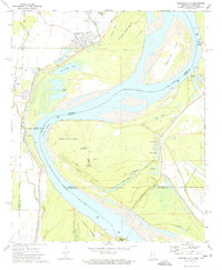
1972 Map of Arkansas City
USGS Topo · Published 1974About this map
Arkansas City stands at the edge of a shifting riverine landscape where the Mississippi River defines the border between Arkansas and Mississippi. This 1970s survey illustrates a region shaped by hydrological engineering and historical transport, marked by the extensive Levee system and an Old Railroad Grade that once connected the riverfront to the interior. The map captures a complex network of oxbow lakes and chutes, including Kate Adams Lake and Whiskey Chute, which reflect the river's historical path before stabilization.
Find a feature on this map
38 named features on this map. Tap any name to fly to it.
Don’t see what you’re looking for? This feature index may not catch every label — zoom into the map to look around manually.
Map Details
Editions of this 1972 Arkansas City Map
This is the sole edition of this map. No revisions or reprints were ever made.
Other maps of this area

1933 · Lamont
USGS Topo · 1:62,500

1936 · McGehee
USGS Topo · 1:62,500

1936 · Lake Village
USGS Topo · 1:62,500

1937 · McGehee
USGS Topo · 1:62,500

1939 · Refuge
USGS Topo · 1:62,500

1939 · Lamont
USGS Topo · 1:62,500

1953 · Greenwood
USGS Topo · 1:250,000

1955 · Lake Village
USGS Topo · 1:62,500

1955 · McGehee
USGS Topo · 1:62,500

1956 · Greenwood
USGS Topo · 1:250,000