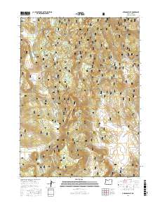
2017 Map of Arkansas Flat
USGS Topo · Published 2017About this map
Fremont National Forest dominates this high-elevation landscape, where a sophisticated network of small reservoirs and mountain springs sustains the local ecology. The map reveals a high-country plateau characterized by seasonal water storage, featuring the Big Swamp Reservoir, Lapham Reservoir, and Arkansas Reservoir. This area in t39s r16e serves as a critical watershed, with numerous named springs such as Sullivan Spring and Blue Monday Spring feeding into Fishhole Cr and Barnes Valley Cr.
Find a feature on this map
62 named features on this map. Tap any name to fly to it.
Don’t see what you’re looking for? This feature index may not catch every label — zoom into the map to look around manually.
Map Details
Editions of this 2017 Arkansas Flat Map
This is the sole edition of this map. No revisions or reprints were ever made.
Other maps of this area

1955 · Klamath Falls
USGS Topo · 1:250,000

1958 · Klamath Falls
USGS Topo · 1:250,000

1960 · Strawberry Butte
USGS Topo · 1:62,500

1960 · Fishhole Mtn
USGS Topo · 1:62,500

1964 · Drews Reservoir
USGS Topo · 1:24,000
1964 · Dog Lake
USGS Topo · 1:24,000

1964 · Cougar Peak
USGS Topo · 1:24,000

1975 · Lakeview
USGS Topo · 1:100,000
1988 · Arkansas Flat
USGS Topo · 1:24,000
1988 · Barnes Valley
USGS Topo · 1:24,000