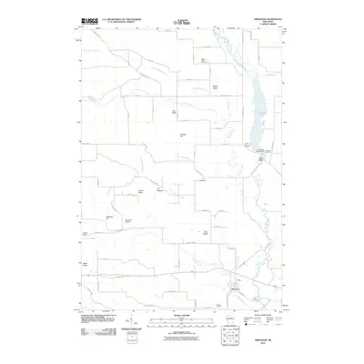
2010 Map of Arkansaw
USGS Topo · Published 2010About this map
Arkansaw and Eau Galle anchor this study of the river valley in western Wisconsin, where the Eau Galle River transitions into the expansive Lake Eau Galle. The landscape is defined by its water system, including the Eau Galle WP 193 Dam and numerous tributary creeks like Little Missouri Creek and Little Arkansas Creek. For those researching local families, the map provides precise locations for several burial grounds, including Weber Valley Cemetery, Saint Henrys Cemetery, and French Cemetery. Notable topographic landmarks such as The Hogback, Stringer Hill, and Devils Gate break the terrain, while smaller coulees and ridges like Joe Gray Coulee and Maple Ridge reveal the complex drainage patterns and farm-to-market road networks that have shaped this community in the 21st century.
Find a feature on this map
64 named features on this map. Tap any name to fly to it.
Don’t see what you’re looking for? This feature index may not catch every label — zoom into the map to look around manually.
Map Details
Editions of this 2010 Arkansaw Map
This is the sole edition of this map. No revisions or reprints were ever made.
Other maps of this area

1929 · Durand
USGS Topo · 1:62,500

1932 · Durand
USGS Topo · 1:62,500

1935 · Arkansaw
USGS Topo · 1:48,000

1940 · Menomonie
USGS Topo · 1:62,500

1941 · Arkansaw
USGS Topo · 1:62,500

1942 · Arkansaw
USGS Topo · 1:62,500

1942 · Menomonie
USGS Topo · 1:62,500

1946 · Knapp
USGS Topo · 1:62,500

1949 · Knapp
USGS Topo · 1:62,500

1953 · Saint Paul
USGS Topo · 1:250,000