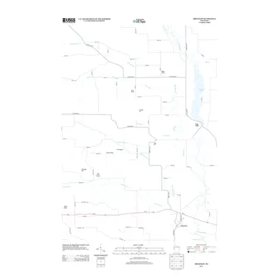
2013 Map of Arkansaw
USGS Topo · Published 2013About this map
Arkansaw and Eau Galle anchor this landscape where the Eau Galle River and its various tributaries carve through the upland terrain of western Wisconsin. The hydrology is the defining characteristic of the area, featuring Lake Eau Galle and a complex network of streams including Little Missouri Cr, Missouri Cr, and Little Arkansaw Cr. The topography is marked by distinct ridges and named rises such as Coburn Ridge, Maple Ridge, and the sharp prominence of The Hogback.
Find a feature on this map
62 named features on this map. Tap any name to fly to it.
Don’t see what you’re looking for? This feature index may not catch every label — zoom into the map to look around manually.
Map Details
Editions of this 2013 Arkansaw Map
This is the sole edition of this map. No revisions or reprints were ever made.
Other maps of this area

1929 · Durand
USGS Topo · 1:62,500

1932 · Durand
USGS Topo · 1:62,500

1935 · Arkansaw
USGS Topo · 1:48,000

1940 · Menomonie
USGS Topo · 1:62,500

1941 · Arkansaw
USGS Topo · 1:62,500

1942 · Arkansaw
USGS Topo · 1:62,500

1942 · Menomonie
USGS Topo · 1:62,500

1946 · Knapp
USGS Topo · 1:62,500

1949 · Knapp
USGS Topo · 1:62,500

1953 · Saint Paul
USGS Topo · 1:250,000