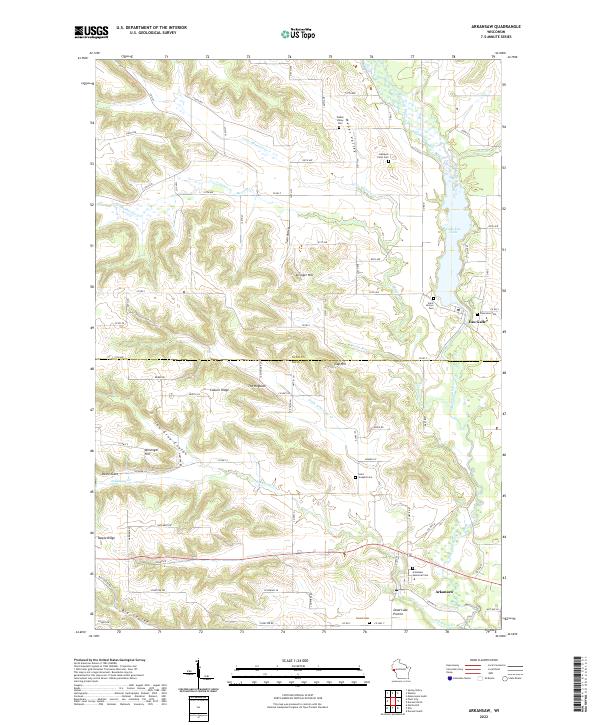
2022 Map of Arkansaw
USGS Topo · Published 2022About this map
Arkansaw and Eau Galle anchor this modern survey of the border between Dunn and Pepin Counties, where the landscape is defined by the sharp transition from high ridges to fertile coulees. The Eau Galle River flows through the eastern corridor, expanding into Lake Eau Galle just north of the village. The terrain is marked by significant topographic features such as The Hogback and Coburn Ridge, which rise above the complex network of valleys like Weber Valley and Big Coulee. This area is particularly rich for genealogists, featuring several small burial grounds including Gasteyer Farm Cem and Saint Josephs Cem. The map illustrates a rural economy organized around family-named landmarks and a grid of county highways, including Co HWY G and Co HWY D, which connect the scattered homesteads of Maple Ridge and the broad flats of Dead Lake Prairie.
Find a feature on this map
70 named features on this map. Tap any name to fly to it.
Don’t see what you’re looking for? This feature index may not catch every label — zoom into the map to look around manually.
Map Details
Editions of this 2022 Arkansaw Map
This is the sole edition of this map. No revisions or reprints were ever made.
Other maps of this area

1929 · Durand
USGS Topo · 1:62,500

1932 · Durand
USGS Topo · 1:62,500

1935 · Arkansaw
USGS Topo · 1:48,000

1940 · Menomonie
USGS Topo · 1:62,500

1941 · Arkansaw
USGS Topo · 1:62,500

1942 · Arkansaw
USGS Topo · 1:62,500

1942 · Menomonie
USGS Topo · 1:62,500

1946 · Knapp
USGS Topo · 1:62,500

1949 · Knapp
USGS Topo · 1:62,500

1953 · Saint Paul
USGS Topo · 1:250,000