
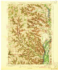
1942 Map of Arkansaw
USGS Topo · Published 1942About this map
Arkansaw and Plum City anchor a landscape deeply etched by the driftless-style drainage of the Chippewa River and its tributaries during the early 1940s. The map reveals an exceptionally dense network of rural schoolhouses, such as Missouri Valley Sch, Clipperdale Sch, and Maxville Prairie Sch, illustrating the dispersed settlement pattern of this agricultural region in Pierce and Pepin counties. The rugged topography is defined by named coulees and bluffs, including Brunner Valley and the prominent Hellsing Bluff near the southern border.
Find a feature on this map
81 named features on this map. Tap any name to fly to it.
Don’t see what you’re looking for? This feature index may not catch every label — zoom into the map to look around manually.
Map Details
Editions of this 1942 Arkansaw Map
2 editions found
Other maps of this area

1929 · Durand
USGS Topo · 1:62,500

1932 · Wabasha
USGS Topo · 1:62,500

1932 · Durand
USGS Topo · 1:62,500

1932 · Alma
USGS Topo · 1:62,500

1935 · Arkansaw
USGS Topo · 1:48,000

1940 · Maiden Rock
USGS Topo · 1:62,500

1940 · Menomonie
USGS Topo · 1:62,500

1941 · Arkansaw
USGS Topo · 1:62,500

1942 · Menomonie
USGS Topo · 1:62,500

1946 · Knapp
USGS Topo · 1:62,500