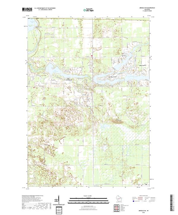
2022 Map of Arkdale NE
USGS Topo · Published 2022About this map
Lake Camelot and Lake Sherwood define the residential and recreational geography of this portion of Adams County. These man-made water bodies, connected by Fourteenmile Creek, are surrounded by a dense network of suburban-style naming conventions, including Apache Ave and Kings Way. The landscape shifts from these developed lakefronts to the natural undulations of the Driftless Area, marked by features such as Dorra Cooshe Mtn and the sharp bend of Devils Elbow near Petenwell Lake.
Find a feature on this map
67 named features on this map. Tap any name to fly to it.
Don’t see what you’re looking for? This feature index may not catch every label — zoom into the map to look around manually.
Map Details
Editions of this 2022 Arkdale NE Map
This is the sole edition of this map. No revisions or reprints were ever made.
Other maps of this area

1955 · Green Bay
USGS Topo · 1:250,000

1957 · Wisconsin Rapids
USGS Topo · 1:48,000

1957 · Whiting
USGS Topo · 1:48,000

1958 · Arkdale
USGS Topo · 1:48,000

1958 · Coloma
USGS Topo · 1:48,000

1967 · Roche A Cri
USGS Topo · 1:24,000

1967 · Arkdale NE
USGS Topo · 1:24,000

1967 · Wisconsin Rapids
USGS Topo · 1:62,500
1967 · Arkdale
USGS Topo · 1:24,000

1968 · Coloma NW
USGS Topo · 1:24,000