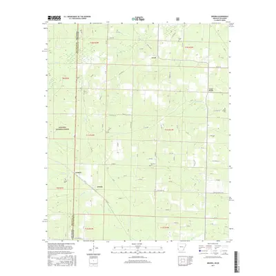
2017 Map of Arkinda
USGS Topo · Published 2017About this map
Arkinda and Jewell anchor this pocket of the Arkansas-Oklahoma borderlands in Little River Co and McCurtain County. The landscape is defined by the headwaters and tributaries of several creeks, including Hurricane Cr, Calton Cr, and the various forks of Caney Cr. Settlement patterns are largely rural, centered on local family burial grounds and small communities such as Eastport and Cross Roads. A significant portion of the western territory is designated within the Ouachita National Forest, while the eastern portion is crisscrossed by a network of county roads like Jewell Hill Rd and Tower Hill Rd. Researchers can find evidence of local industry at Charcoal Plant Rd, while genealogists will find numerous small sites of rest including Strawn Cem, Piney Cem, and the Camp Grounds Cem.
Find a feature on this map
100 named features on this map. Tap any name to fly to it.
Don’t see what you’re looking for? This feature index may not catch every label — zoom into the map to look around manually.
Map Details
Editions of this 2017 Arkinda Map
This is the sole edition of this map. No revisions or reprints were ever made.
Other maps of this area

1950 · Tom
USGS Topo · 1:24,000

1950 · Winthrop
USGS Topo · 1:24,000

1950 · Goodwater
USGS Topo · 1:24,000

1950 · Bokhoma
USGS Topo · 1:24,000

1951 · Winthrop
USGS Topo · 1:24,000

1951 · Tom
USGS Topo · 1:24,000

1951 · Bokhoma
USGS Topo · 1:24,000

1951 · Goodwater
USGS Topo · 1:24,000

1951 · Arden
USGS Topo · 1:24,000

1951 · Arkinda
USGS Topo · 1:24,000