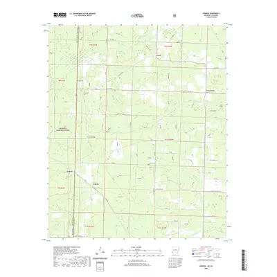
2020 Map of Arkinda
USGS Topo · Published 2020About this map
The Oklahoma-Arkansas border defines the western edge of this landscape, where the wooded uplands of the Ouachita National Forest meet the creek valleys of Little River County. Small settlements such as Arkinda, Jewell, and Eastport anchor a network of rural roads, including the Little River 375 Charcoal-Plant Road and Jewell Hill Road. The area is notably dense with small family and community burial grounds, from the Piney Cem near the state line to the Camp Grounds Cem further east. A complex drainage system feeds the region, characterized by numerous winding waterways like Hurricane Creek, Yellow Branch, and Cooper Creek, which flow through the timbered terrain and under the paths of State Highway 234.
Find a feature on this map
98 named features on this map. Tap any name to fly to it.
Don’t see what you’re looking for? This feature index may not catch every label — zoom into the map to look around manually.
Map Details
Editions of this 2020 Arkinda Map
This is the sole edition of this map. No revisions or reprints were ever made.
Other maps of this area

1950 · Tom
USGS Topo · 1:24,000

1950 · Winthrop
USGS Topo · 1:24,000

1950 · Goodwater
USGS Topo · 1:24,000

1950 · Bokhoma
USGS Topo · 1:24,000

1951 · Winthrop
USGS Topo · 1:24,000

1951 · Tom
USGS Topo · 1:24,000

1951 · Bokhoma
USGS Topo · 1:24,000

1951 · Goodwater
USGS Topo · 1:24,000

1951 · Arden
USGS Topo · 1:24,000

1951 · Arkinda
USGS Topo · 1:24,000