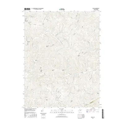
2016 Map of Arlee
USGS Topo · Published 2016About this map
Arlee and Mohrtown anchor this portion of the West Virginia landscape, where the terrain is defined by a dense network of high ridges and narrow hollows. The map reveals a high concentration of family and community burial sites, including Potts Chapel Cem and Mountain Valley Cem, which often sit atop or alongside prominent landforms like Potts Chapel Ridge and Loggerhead Ridge. The drainage pattern is complex, with numerous branches and runs such as Sixteenmile Cr, Wolfpen Run, and Crab Creek carving through the hills.
Find a feature on this map
95 named features on this map. Tap any name to fly to it.
Don’t see what you’re looking for? This feature index may not catch every label — zoom into the map to look around manually.
Map Details
Editions of this 2016 Arlee Map
This is the sole edition of this map. No revisions or reprints were ever made.
Other maps of this area

1906 · Glenwood
USGS Topo · 1:62,500

1906 · Winfield
USGS Topo · 1:62,500

1908 · Glenwood
USGS Topo · 1:62,500

1908 · Winfield
USGS Topo · 1:62,500

1908 · Ravenswood
USGS Topo · 1:62,500

1908 · Point Pleasant
USGS Topo · 1:62,500

1926 · Ravenswood
USGS Topo · 1:62,500

1926 · Point Pleasant
USGS Topo · 1:62,500

1928 · Ravenswood
USGS Topo · 1:62,500

1929 · Point Pleasant
USGS Topo · 1:62,500