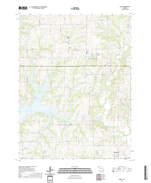
2021 Map of Arley
USGS Topo · Published 2021About this map
Kearney anchors the southeast corner of this Missouri landscape, where the northern reaches of Clay County meet the Clinton County line. The terrain is defined by the dendritic drainage patterns of Owl Creek, Eberts Branch, and Holtzclaw Creek, which feed into larger impoundments like Hal Reed Lake and the Number 159 Reservoir. These waterways shape the rural road network, which transitions from named streets near the burgeoning settlement of Kearney to numbered county roads further north.
Find a feature on this map
93 named features on this map. Tap any name to fly to it.
Don’t see what you’re looking for? This feature index may not catch every label — zoom into the map to look around manually.
Map Details
Editions of this 2021 Arley Map
This is the sole edition of this map. No revisions or reprints were ever made.
Other maps of this area

1890 · Kansas City
USGS Topo · 1:125,000

1894 · Kansas City
USGS Topo · 1:125,000

1894 · Independence
USGS Topo · 1:125,000

1914 · Smithville
USGS Topo · 1:62,500

1925 · Gower
USGS Topo · 1:62,500

1925 · Plattsburg
USGS Topo · 1:62,500

1936 · Kearney
USGS Topo · 1:48,000

1942 · Kearney
USGS Topo · 1:62,500

1945 · Kearney
USGS Topo · 1:62,500
1948 · Nashua
USGS Topo · 1:24,000