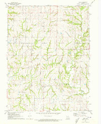
1971 Map of Arley
USGS Topo · Published 1973About this map
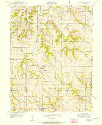
Lilly and Arley serve as the primary focal points of this rural landscape where the border of Clinton and Clay counties meets. The terrain is defined by a dense network of drainage, including Owl Creek, Eberts Branch, and Camp Branch, which feed into Clear Creek. The area’s genealogical record is remarkably well-preserved on this sheet, featuring numerous family and community burial grounds such as Fairview Cem, Eberts Cem, Mt Zion Cem, and Cook Cem. In the southern portion near the Gilmore Branch, the Mt Gilead Ch and Ecton Cem stand as markers of long-established community centers. The distribution of these small cemeteries and churches suggests a settlement pattern of independent farmsteads and small rural hamlets common to western Missouri during the early 1970s.
Find a feature on this map
19 named features on this map. Tap any name to fly to it.
Don’t see what you’re looking for? This feature index may not catch every label — zoom into the map to look around manually.
Map Details
Editions of this 1971 Arley Map
This is the sole edition of this map. No revisions or reprints were ever made.
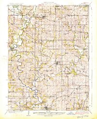
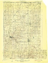
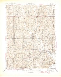
Other maps of this area

1890 · Kansas City
USGS Topo · 1:125,000

1894 · Kansas City
USGS Topo · 1:125,000

1894 · Independence
USGS Topo · 1:125,000

1914 · Smithville
USGS Topo · 1:62,500
1925 · Gower
USGS Topo · 1:62,500
1925 · Plattsburg
USGS Topo · 1:62,500

1936 · Kearney
USGS Topo · 1:48,000

1942 · Kearney
USGS Topo · 1:62,500
1945 · Kearney
USGS Topo · 1:62,500
1948 · Nashua
USGS Topo · 1:24,000