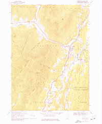
1967 Map of Arlington
USGS Topo · Published 1977About this map
The Batten Kill valley serves as the central corridor for this mid-1960s survey, documenting the settlements of Arlington, West Arlington, and East Arlington along its banks. The landscape is defined by the sharp transition between the river bottomlands and the steep slopes of Big Spruce Mountain and Grass Mountain. This era shows a community rooted in its geographic constraints, where the Vermont railroad and local roads follow the narrow passage carved by the water.
Find a feature on this map
41 named features on this map. Tap any name to fly to it.
Don’t see what you’re looking for? This feature index may not catch every label — zoom into the map to look around manually.
Map Details
Editions of this 1967 Arlington Map
2 editions found
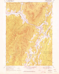
Other maps of this area

1894 · Equinox
USGS Topo · 1:62,500

1895 · Cambridge
USGS Topo · 1:62,500

1896 · Equinox
USGS Topo · 1:62,500

1897 · Hoosick
USGS Topo · 1:62,500

1898 · Cambridge
USGS Topo · 1:62,500

1898 · Bennington
USGS Topo · 1:62,500

1900 · Taconic
USGS Topo · 1:125,000

1900 · Equinox
USGS Topo · 1:62,500

1901 · Cambridge
USGS Topo · 1:62,500

1903 · Mettawee
USGS Topo · 1:125,000