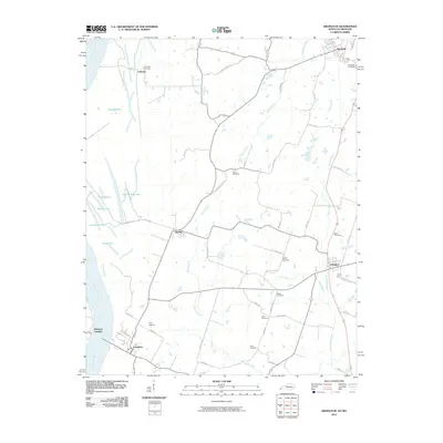
2010 Map of Arlington
USGS Topo · Published 2010About this map
The Mississippi River floodplain and its upland bluffs define the landscape of western Kentucky in this recent topographic survey. The river's influence is evident in the cluster of oxbow lakes and ponds near Belmont Landing, including Black Lake, Number 4 Lake, and Indian Camp Lake. Moving inland, the terrain transitions to a network of creeks and small settlements connected by a grid of rural roads. The towns of Arlington and Bardwell anchor the eastern side of the map, while smaller locales like Berkley and Laketon are situated further west. For genealogists, the map is remarkably dense with family-named landmarks, particularly cemeteries such as Taylor Cemetery, Allred Cemetery, and Campbell Cemetery, which are scattered throughout the agricultural landscape along tributaries like Bowles Creek and Hurricane Creek.
Find a feature on this map
56 named features on this map. Tap any name to fly to it.
Don’t see what you’re looking for? This feature index may not catch every label — zoom into the map to look around manually.
Map Details
Editions of this 2010 Arlington Map
This is the sole edition of this map. No revisions or reprints were ever made.
Other maps of this area

1939 · Wickliffe
USGS Topo · 1:62,500

1939 · Hickman
USGS Topo · 1:62,500

1951 · Blandville
USGS Topo · 1:24,000

1951 · Oakton
USGS Topo · 1:24,000

1951 · Wolf Island
USGS Topo · 1:24,000

1951 · Wickliffe SW
USGS Topo · 1:24,000

1951 · Arlington
USGS Topo · 1:24,000

1951 · Wickliffe
USGS Topo · 1:24,000

1951 · Milburn
USGS Topo · 1:24,000

1952 · Clinton
USGS Topo · 1:24,000