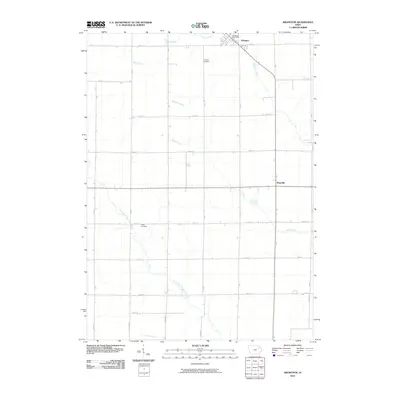
2010 Map of Arlington
USGS Topo · Published 2010About this map
Arlington anchors the northern reaches of this landscape, situated near the confluence of several local waterways. The town center is marked by the Arlington Post Office and serves as a junction for the surrounding agricultural grid. To the south, the village of Maryville sits along a north-south arterial route, providing a secondary hub for the rural community.
Find a feature on this map
30 named features on this map. Tap any name to fly to it.
Don’t see what you’re looking for? This feature index may not catch every label — zoom into the map to look around manually.
Map Details
Editions of this 2010 Arlington Map
This is the sole edition of this map. No revisions or reprints were ever made.
Other maps of this area

1901 · Oelwein
USGS Topo · 1:125,000

1959 · Dubuque
USGS Topo · 1:250,000

1961 · Dubuque
USGS Topo · 1:250,000

1962 · Dubuque
USGS Topo · 1:250,000

1965 · Wadena
USGS Topo · 1:24,000

1965 · Strawberry Point
USGS Topo · 1:24,000

1965 · Arlington
USGS Topo · 1:24,000
1965 · Volga
USGS Topo · 1:24,000

1965 · Lamont
USGS Topo · 1:24,000

1965 · Dundee
USGS Topo · 1:24,000