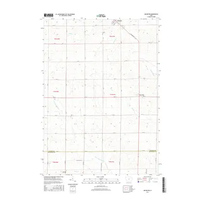
2015 Map of Arlington
USGS Topo · Published 2015About this map
Arlington sits at the northern edge of this landscape, where the street grid of Upper St and High St meets the rural agricultural sections of Fayette and Buchanan counties. The terrain is defined by the drainage patterns of the Maquoketa River and its various tributaries, including Bruce Cr and Brush Cr, which carve through the Iowa prairie. This modern survey reflects a deeply established rural infrastructure, where a grid of section-line roads like 80th St and G Ave connects small centers like Maryville and the town of Aurora. Researchers will find significant genealogical sites such as Arlington Cem and Union Cem, alongside local landmarks like the S Fork Maquoketa River. The map illustrates the transition from organized municipal centers to the sprawling farmsteads that characterize this part of Northeast Iowa.
Find a feature on this map
46 named features on this map. Tap any name to fly to it.
Don’t see what you’re looking for? This feature index may not catch every label — zoom into the map to look around manually.
Map Details
Editions of this 2015 Arlington Map
This is the sole edition of this map. No revisions or reprints were ever made.
Other maps of this area

1901 · Oelwein
USGS Topo · 1:125,000

1959 · Dubuque
USGS Topo · 1:250,000

1961 · Dubuque
USGS Topo · 1:250,000

1962 · Dubuque
USGS Topo · 1:250,000

1965 · Wadena
USGS Topo · 1:24,000

1965 · Strawberry Point
USGS Topo · 1:24,000

1965 · Arlington
USGS Topo · 1:24,000
1965 · Volga
USGS Topo · 1:24,000

1965 · Lamont
USGS Topo · 1:24,000

1965 · Dundee
USGS Topo · 1:24,000