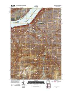
2011 Map of Arlington
USGS Topo · Published 2011About this map
Arlington sits along the southern shore of the Columbia River, serving as a critical junction for river and rail transportation. The 2011 landscape reveals a mix of civic infrastructure and agricultural history, with the Arlington Post Office and Arlington Masonic Cemetery established near the town center, while the Arlington Rodeo Grounds highlight local cultural traditions. South of the river, the engineered course of the China Ditch winds through the terrain toward West Fork Shutler Creek, illustrating the region's historical reliance on irrigation and water management. Across the water, the settlement of Roosevelt marks the northern bank, connected to the Oregon side by the path of Roosevelt Ferry Rd. High on the plateau, the map identifies specific outposts such as West Hurlburt Camp and Pebble Springs Camp scattered across the Hurlburt Flats, showing the continued significance of these remote stations in the high desert geography.
Find a feature on this map
21 named features on this map. Tap any name to fly to it.
Don’t see what you’re looking for? This feature index may not catch every label — zoom into the map to look around manually.
Map Details
Editions of this 2011 Arlington Map
This is the sole edition of this map. No revisions or reprints were ever made.
Other maps of this area

1916 · Arlington
USGS Topo · 1:125,000

1953 · The Dalles
USGS Topo · 1:250,000

1956 · The Dalles
USGS Topo · 1:250,000

1957 · The Dalles
USGS Topo · 1:250,000

1962 · Heppner Junction
USGS Topo · 1:24,000

1962 · Wood Gulch
USGS Topo · 1:24,000

1964 · Turner Butte
USGS Topo · 1:24,000

1964 · Shutler Flat
USGS Topo · 1:24,000

1964 · Hickland Butte
USGS Topo · 1:24,000
1964 · Horn Butte
USGS Topo · 1:24,000