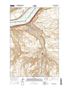
2017 Map of Arlington
USGS Topo · Published 2017About this map
Arlington sits at the northern edge of the Columbia Plateau, where the high desert terrain of Oregon meets the wide expanse of the Columbia River. This landscape is defined by the sharp transition from the river's edge at Lake Umatilla to the elevated plateaus of Hurlburt Flats. The town's layout is centered around local arteries like Main St and Cottonwood St, while the Arlington Municipal Airport occupies the bench land above the community.
Find a feature on this map
33 named features on this map. Tap any name to fly to it.
Don’t see what you’re looking for? This feature index may not catch every label — zoom into the map to look around manually.
Map Details
Editions of this 2017 Arlington Map
This is the sole edition of this map. No revisions or reprints were ever made.
Other maps of this area

1916 · Arlington
USGS Topo · 1:125,000

1953 · The Dalles
USGS Topo · 1:250,000

1956 · The Dalles
USGS Topo · 1:250,000

1957 · The Dalles
USGS Topo · 1:250,000

1962 · Heppner Junction
USGS Topo · 1:24,000

1962 · Wood Gulch
USGS Topo · 1:24,000

1964 · Turner Butte
USGS Topo · 1:24,000

1964 · Shutler Flat
USGS Topo · 1:24,000

1964 · Hickland Butte
USGS Topo · 1:24,000
1964 · Horn Butte
USGS Topo · 1:24,000