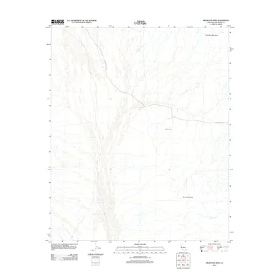
2012 Map of Arlington Mine
USGS Topo · Published 2012About this map
Arlington Mine sits at the heart of this desert landscape in eastern Riverside County, positioned between significant geological formations. The terrain is defined by the Little Maria Mountains to the north and the Mc Coy Mountains to the south, with the drainage of McCoy Wash cutting through the arid expanse. This 2012 survey illustrates the isolated nature of mining operations in the region, where infrastructure is limited to essential desert tracks. Access to this remote industrial site is provided by Arlington Mine Rd and Coxcomb Monument Rd, highlighting the specialized road network required to service the interior of the California desert. The map captures a moment in the modern era of desert land use where the geography remains dominated by natural features and historical mining interests.
Find a feature on this map
6 named features on this map. Tap any name to fly to it.
Don’t see what you’re looking for? This feature index may not catch every label — zoom into the map to look around manually.
Map Details
Editions of this 2012 Arlington Mine Map
This is the sole edition of this map. No revisions or reprints were ever made.
Other maps of this area

1942 · Blythe
USGS Topo · 1:250,000

1945 · Midland
USGS Topo · 1:62,500

1952 · Midland
USGS Topo · 1:62,500

1952 · Mc Coy Spring
USGS Topo · 1:62,500

1952 · Sidewinder Well
USGS Topo · 1:62,500

1952 · Palen Mountains
USGS Topo · 1:62,500

1954 · Salton Sea
USGS Topo · 1:250,000

1955 · Salton Sea
USGS Topo · 1:250,000

1959 · Salton Sea
USGS Topo · 1:250,000

1963 · Salton Sea
USGS Topo · 1:250,000