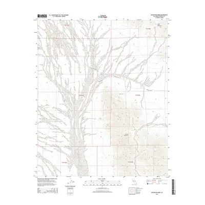
2015 Map of Arlington Mine
USGS Topo · Published 2015About this map
The Arlington Mine serves as a central landmark in this desert region of Riverside County, situated at the base of the McCoy Mountains. This 2015 survey illustrates a landscape defined by expansive drainage systems, most notably the braided channels of McCoy Wash that dominate the western half of the map. Historically significant travel routes such as Pattons Cabin Rd and Arlington Mine Rd provide access to the interior, reflecting the area's long association with mining and military training. In the north, the terrain rises toward the Little Maria Mountains, while the central portion is defined by the high relief of the McCoys. The map's grid of section lines and township boundaries, including t4s r20e, overlay a territory where natural topography and seasonal water flow dictate the path of every road and settlement site.
Find a feature on this map
13 named features on this map. Tap any name to fly to it.
Don’t see what you’re looking for? This feature index may not catch every label — zoom into the map to look around manually.
Map Details
Editions of this 2015 Arlington Mine Map
This is the sole edition of this map. No revisions or reprints were ever made.
Other maps of this area

1942 · Blythe
USGS Topo · 1:250,000

1945 · Midland
USGS Topo · 1:62,500

1952 · Midland
USGS Topo · 1:62,500

1952 · Mc Coy Spring
USGS Topo · 1:62,500

1952 · Sidewinder Well
USGS Topo · 1:62,500

1952 · Palen Mountains
USGS Topo · 1:62,500

1954 · Salton Sea
USGS Topo · 1:250,000

1955 · Salton Sea
USGS Topo · 1:250,000

1959 · Salton Sea
USGS Topo · 1:250,000

1963 · Salton Sea
USGS Topo · 1:250,000