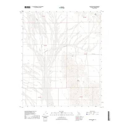
2018 Map of Arlington Mine
USGS Topo · Published 2018About this map
The Arlington Mine serves as the focal point of this arid landscape in Riverside County, situated where the sloping fans of the desert floor meet the northern reaches of the McCoy Mountains. This modern topographic study reveals the sparse industrial infrastructure of the region, defined primarily by two remote transport corridors: Palen Pass Rd and Arlington Mine Rd. To the northeast, the terrain ascends toward the Little Maria Mountains, with the map clearly delineating the complex drainage patterns and dry washes that shape the alluvial plains. This area is characterized by a lack of permanent settlements, highlighting its role as a specialized site for mineral extraction and desert transit within the vast public lands of Southern California.
Find a feature on this map
11 named features on this map. Tap any name to fly to it.
Don’t see what you’re looking for? This feature index may not catch every label — zoom into the map to look around manually.
Map Details
Editions of this 2018 Arlington Mine Map
This is the sole edition of this map. No revisions or reprints were ever made.
Other maps of this area

1942 · Blythe
USGS Topo · 1:250,000

1945 · Midland
USGS Topo · 1:62,500

1952 · Midland
USGS Topo · 1:62,500

1952 · Mc Coy Spring
USGS Topo · 1:62,500

1952 · Sidewinder Well
USGS Topo · 1:62,500

1952 · Palen Mountains
USGS Topo · 1:62,500

1954 · Salton Sea
USGS Topo · 1:250,000

1955 · Salton Sea
USGS Topo · 1:250,000

1959 · Salton Sea
USGS Topo · 1:250,000

1963 · Salton Sea
USGS Topo · 1:250,000