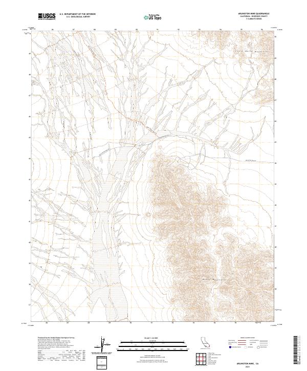
2021 Map of Arlington Mine
USGS Topo · Published 2021About this map
Arid desert basins and dramatic elevation changes define this stretch of Riverside County, where the southern reaches of the Little Maria Mountains meet the northern slopes of the McCoy Mountains. The landscape is characterized by extensive alluvial fans and dry wash systems that drain from the surrounding peaks into the broad central valley. Modern access through this remote terrain is maintained via Arlington Mine Rd, which cuts through the heart of the quadrangle to support historical mining interests in the region.
Find a feature on this map
11 named features on this map. Tap any name to fly to it.
Don’t see what you’re looking for? This feature index may not catch every label — zoom into the map to look around manually.
Map Details
Editions of this 2021 Arlington Mine Map
This is the sole edition of this map. No revisions or reprints were ever made.
Other maps of this area

1942 · Blythe
USGS Topo · 1:250,000

1945 · Midland
USGS Topo · 1:62,500

1952 · Midland
USGS Topo · 1:62,500

1952 · Mc Coy Spring
USGS Topo · 1:62,500

1952 · Sidewinder Well
USGS Topo · 1:62,500

1952 · Palen Mountains
USGS Topo · 1:62,500

1954 · Salton Sea
USGS Topo · 1:250,000

1955 · Salton Sea
USGS Topo · 1:250,000

1959 · Salton Sea
USGS Topo · 1:250,000

1963 · Salton Sea
USGS Topo · 1:250,000