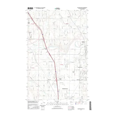
2017 Map of Arlington West
USGS Topo · Published 2017About this map
The Island sits at a prominent bend in the Stillaguamish River, highlighting a landscape defined by the river's path through Snohomish County. The Stillaguamish River Bridge and various crossings connect the urban development of Arlington and northern Marysville with the surrounding rural terrain. This 2017 survey shows a complex interface of modern transportation and aviation, centered on the Arlington Municipal Airport, while maintaining ties to older community nodes such as Arlington Junction and Sisco.
Find a feature on this map
172 named features on this map. Tap any name to fly to it.
Don’t see what you’re looking for? This feature index may not catch every label — zoom into the map to look around manually.
Map Details
Editions of this 2017 Arlington West Map
This is the sole edition of this map. No revisions or reprints were ever made.
Other maps of this area

1911 · Mount Vernon
USGS Topo · 1:125,000

1940 · Mt Vernon
USGS Topo · 1:62,500

1941 · Marysville
USGS Topo · 1:62,500

1943 · Marysville
USGS Topo · 1:62,500

1943 · Mt Vernon
USGS Topo · 1:62,500

1943 · Stanwood
USGS Topo · 1:62,500

1944 · Clear Lake
USGS Topo · 1:62,500

1956 · Tulalip
USGS Topo · 1:24,000

1956 · Arlington West
USGS Topo · 1:24,000

1956 · Arlington East
USGS Topo · 1:24,000