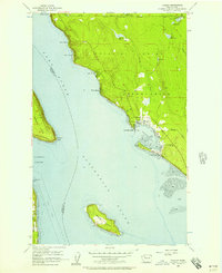
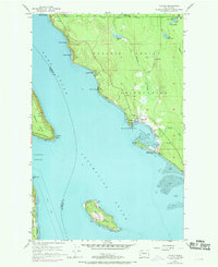
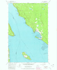
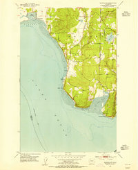
1956 Map of Tulalip
USGS Topo · Published 1957About this map
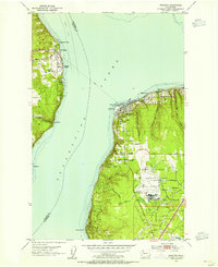
The Tulalip Indian Reservation coastline is the central focus of this 1950s survey, revealing a landscape defined by saltwater passages and shorefront settlements. Waterfront communities such as Spee-Bi-Dah, Sunny Shores, and Tulare Beach line the eastern edge of Port Susan, while the more established hub of Tulalip sits at the head of Tulalip Bay. Inland, the terrain is dotted with small lakes, including Mary Shelton Lake and Lake Shoecraft, connected by the narrow Fire Trail Road.
Find a feature on this map
41 named features on this map. Tap any name to fly to it.
Don’t see what you’re looking for? This feature index may not catch every label — zoom into the map to look around manually.
Map Details
Editions of this 1956 Tulalip Map
4 editions found

Other maps of this area

1895 · Snohomish
USGS Topo · 1:125,000

1897 · Seattle
USGS Topo · 1:125,000

1911 · Mount Vernon
USGS Topo · 1:125,000

1941 · Marysville
USGS Topo · 1:62,500

1942 · Edmonds
USGS Topo · 1:62,500

1943 · Marysville
USGS Topo · 1:62,500

1943 · Stanwood
USGS Topo · 1:62,500

1944 · Everett
USGS Topo · 1:62,500
1953 · Maxwelton
USGS Topo · 1:24,000
1953 · Mukilteo
USGS Topo · 1:24,000