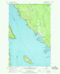
1956 Map of Tulalip
USGS Topo · Published 1969About this map
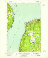
Tulalip Indian Reservation lands dominate this coastal Snohomish County landscape, where the waters of Port Susan meet Possession Sound. The shoreline is dotted with small settlements and beach communities including Tulalip Shores, Tulare Beach, and Sunny Shores, reflecting the mid-century growth of waterfront residential enclaves. At the heart of the reservation, the community of Tulalip sits at the head of Tulalip Bay, supported by local infrastructure like the nearby Cem and multiple small Reservoirs.
Find a feature on this map
41 named features on this map. Tap any name to fly to it.
Don’t see what you’re looking for? This feature index may not catch every label — zoom into the map to look around manually.
Map Details
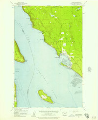
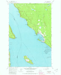
Editions of this 1956 Tulalip Map
4 editions found

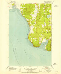
Other maps of this area

1895 · Snohomish
USGS Topo · 1:125,000

1897 · Seattle
USGS Topo · 1:125,000

1911 · Mount Vernon
USGS Topo · 1:125,000

1941 · Marysville
USGS Topo · 1:62,500

1942 · Edmonds
USGS Topo · 1:62,500

1943 · Marysville
USGS Topo · 1:62,500

1943 · Stanwood
USGS Topo · 1:62,500

1944 · Everett
USGS Topo · 1:62,500
1953 · Maxwelton
USGS Topo · 1:24,000
1953 · Mukilteo
USGS Topo · 1:24,000