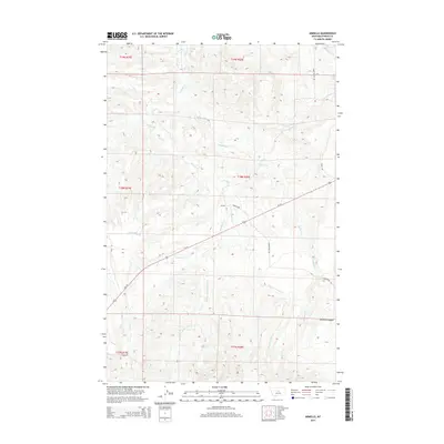
2014 Map of Armells
USGS Topo · Published 2014About this map
Armells lies at the heart of this Fergus County drainage basin, where the Us-191 highway cuts a diagonal path through the high plains. The landscape is defined by the intricate branching of watercourses, including the Middle Fork Armells Cr and E Fork Armells Cr, which carve through the terrain toward the northern boundary. Cattle ranching and rural navigation are evident in the network of named routes like Horse Ranch Rd and Romunstad Rd that connect isolated homesteads and grazing lands. In the southeast, the geography becomes more pronounced as the hills drop into Mitchell Canyon. This 2014 survey documents the enduring spatial layout of Montana's ranching country, capturing the location of the Gilpatrick site and the vital water sources such as the 18N19E24DA 01 Spring that sustain this arid region.
Find a feature on this map
22 named features on this map. Tap any name to fly to it.
Don’t see what you’re looking for? This feature index may not catch every label — zoom into the map to look around manually.
Map Details
Editions of this 2014 Armells Map
This is the sole edition of this map. No revisions or reprints were ever made.
Other maps of this area

1941 · Lewistown
USGS Topo · 1:62,500

1941 · Judith Peak
USGS Topo · 1:62,500

1944 · Lewistown
USGS Topo · 1:62,500

1944 · Judith Peak
USGS Topo · 1:62,500

1954 · Lewistown
USGS Topo · 1:250,000

1959 · Lewistown
USGS Topo · 1:250,000

1978 · Lewistown
USGS Topo · 1:100,000

1985 · The Horse Ranch
USGS Topo · 1:24,000

1985 · Fergus
USGS Topo · 1:24,000

1985 · Hilger
USGS Topo · 1:24,000