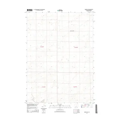
2015 Map of Arminto SW
USGS Topo · Published 2015About this map
Osborne Place stands as a focal point in this high-plains landscape of central Wyoming, where the terrain is defined by the subtle drainage patterns of Poison Cr. This 2015 survey reflects the enduring character of the public land survey system, illustrating the precise grid of section lines and townships such as t36n r89w and t35n r88w that divide the Natrona County rangeland. The map provides a detailed view of the remote homesteading legacy in the region, centered on the named feature of Osborne Place amidst the open topography of the Arminto SW quadrangle.
Find a feature on this map
6 named features on this map. Tap any name to fly to it.
Don’t see what you’re looking for? This feature index may not catch every label — zoom into the map to look around manually.
Map Details
Editions of this 2015 Arminto SW Map
This is the sole edition of this map. No revisions or reprints were ever made.
Other maps of this area

1952 · Arminto
USGS Topo · 1:24,000

1952 · Arminto SW
USGS Topo · 1:24,000

1952 · Madden
USGS Topo · 1:24,000

1952 · Arminto NW
USGS Topo · 1:24,000

1952 · Moneta SE
USGS Topo · 1:24,000

1952 · Miles Ranch
USGS Topo · 1:24,000

1952 · Hiland
USGS Topo · 1:24,000

1952 · Ervay Basin
USGS Topo · 1:24,000

1955 · Arminto
USGS Topo · 1:250,000

1955 · Casper
USGS Topo · 1:250,000