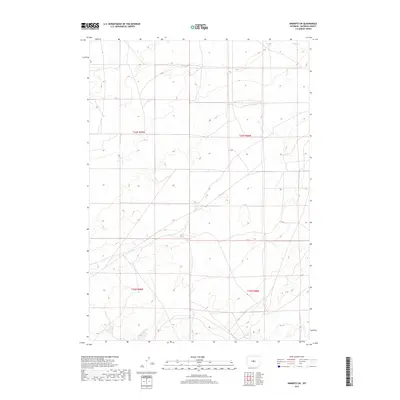
2017 Map of Arminto SW
USGS Topo · Published 2017About this map
The arid high plains of central Wyoming define this region of Natrona County, where the topography is shaped by seasonal drainages like Poison Cr. In this corner of the state, the land is meticulously divided by the Public Land Survey System, as seen in the intersection of townships t36n r89w, t36n r88w, t35n r89w, and t35n r88w. This map illustrates the intersection of vast open spaces and the systematic legal boundaries that govern ranching and land use in the Western interior. Sparse in named settlements but rich in elevation detail, the landscape is a network of ridges and dry creek beds characteristic of the wind-swept basins found between Wyoming's major mountain ranges.
Find a feature on this map
5 named features on this map. Tap any name to fly to it.
Don’t see what you’re looking for? This feature index may not catch every label — zoom into the map to look around manually.
Map Details
Editions of this 2017 Arminto SW Map
This is the sole edition of this map. No revisions or reprints were ever made.
Other maps of this area

1952 · Arminto
USGS Topo · 1:24,000

1952 · Arminto SW
USGS Topo · 1:24,000

1952 · Madden
USGS Topo · 1:24,000

1952 · Arminto NW
USGS Topo · 1:24,000

1952 · Moneta SE
USGS Topo · 1:24,000

1952 · Miles Ranch
USGS Topo · 1:24,000

1952 · Hiland
USGS Topo · 1:24,000

1952 · Ervay Basin
USGS Topo · 1:24,000

1955 · Arminto
USGS Topo · 1:250,000

1955 · Casper
USGS Topo · 1:250,000