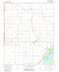
1972 Map of Armorel
USGS Topo · Published 1980About this map
The St Louis - San Francisco railroad cuts a straight horizontal line through this 1970s landscape, anchoring the community of Armorel and the nearby siding at Burton. This era of Mississippi County history shows a highly engineered agricultural environment, where an extensive network of drainage projects like Ditch No 15 and Ditch No 7 have transformed the bottomlands. Along the Mississippi River, the settlement of Barfield sits protected behind a prominent levee system, while the Anderson-Tully State Wildlife Management Area preserves the riverine terrain to the south. Local life is mapped through numerous rural congregations, including New Mt Nebo Ch and Prince of Peace Ch, and the curiously named settlement of Number Nine to the north. Transportation and infrastructure are central to the area, evidenced by the Blytheville Municipal Airport and the Aboveground Pipeline traversing the river's edge.
Find a feature on this map
59 named features on this map. Tap any name to fly to it.
Don’t see what you’re looking for? This feature index may not catch every label — zoom into the map to look around manually.
Map Details
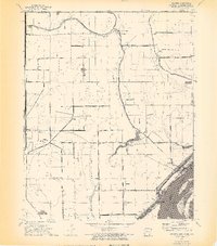
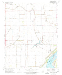
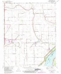
Editions of this 1972 Armorel Map
4 editions found
Other maps of this area

1939 · Hales Point
USGS Topo · 1:62,500

1939 · Caruthersville
USGS Topo · 1:62,500

1939 · Blytheville
USGS Topo · 1:62,500

1940 · Hayti
USGS Topo · 1:62,500

1951 · Caruthersville
USGS Topo · 1:62,500

1952 · Hales Point
USGS Topo · 1:62,500

1955 · Hayti
USGS Topo · 1:62,500

1955 · Blytheville
USGS Topo · 1:62,500

1956 · Dyersburg
USGS Topo · 1:250,000

1956 · Blytheville
USGS Topo · 1:250,000