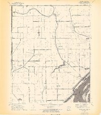
1972 Map of Armorel
USGS Topo · Published 1974About this map
The Mississippi River defines the southeastern edge of this landscape, where the state borders of Arkansas, Missouri, and Tennessee converge. In the early 1970s, the region around Armorel is characterized by a sophisticated network of drainage infrastructure, including Ditch No 44 and Ditch No 15, which supported the productive alluvial plains. The community of Number Nine sits near the Missouri state line, while Barfield and Promised Land occupy the land closer to the river's bend and the Anderson-Tully Wildlife Management Area.
Find a feature on this map
44 named features on this map. Tap any name to fly to it.
Don’t see what you’re looking for? This feature index may not catch every label — zoom into the map to look around manually.
Map Details
Editions of this 1972 Armorel Map
4 editions found
Other maps of this area

1939 · Hales Point
USGS Topo · 1:62,500

1939 · Caruthersville
USGS Topo · 1:62,500

1939 · Blytheville
USGS Topo · 1:62,500

1940 · Hayti
USGS Topo · 1:62,500

1951 · Caruthersville
USGS Topo · 1:62,500

1952 · Hales Point
USGS Topo · 1:62,500

1955 · Hayti
USGS Topo · 1:62,500

1955 · Blytheville
USGS Topo · 1:62,500

1956 · Dyersburg
USGS Topo · 1:250,000

1956 · Blytheville
USGS Topo · 1:250,000