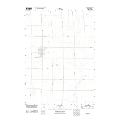
2012 Map of Armour
USGS Topo · Published 2012About this map
Armour serves as the central hub of this Douglas County landscape, organized by a precise grid of rural section roads and residential streets. The community is situated at the intersection of several local routes, including Lumley Ave and Johnson St, which define the town's core residential and commercial layout. Just north of the town center lies the Pleasant Ridge Cem, providing a significant point of interest for those researching local family history and genealogy in the region.
Find a feature on this map
24 named features on this map. Tap any name to fly to it.
Don’t see what you’re looking for? This feature index may not catch every label — zoom into the map to look around manually.
Map Details
Editions of this 2012 Armour Map
This is the sole edition of this map. No revisions or reprints were ever made.
Other maps of this area

1955 · Mitchell
USGS Topo · 1:250,000

1959 · Mitchell
USGS Topo · 1:250,000

1964 · Wagner NE
USGS Topo · 1:24,000

1964 · Ravinia
USGS Topo · 1:24,000
1977 · Wagner NE
USGS Topo · 1:24,000
1978 · Greenwood Colony
USGS Topo · 1:24,000

1979 · Delmont
USGS Topo · 1:24,000
1979 · Armour
USGS Topo · 1:24,000
1979 · Armour SW
USGS Topo · 1:24,000
1979 · Hillside
USGS Topo · 1:24,000