1978 Map of Greenwood Colony
USGS Topo · Published 1979About this map
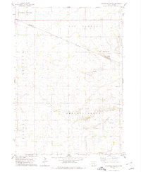
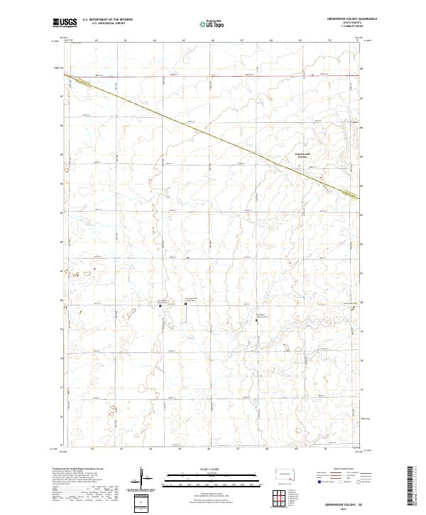
Greenwood Colony serves as a primary point of interest on this high-plains landscape where the Douglas Co Charles Mix Co line meets the Yankton Indian Reservation Boundary. The mapping reveals a rural infrastructure of the late 1970s, defined by section-line roads and scattered community landmarks including St Pauls Ch and School No 4. The meandering path of Choteau Creek provides the principal drainage for the area, cutting through the terrain and separating the distinct townships of East Choteau, Kennedy, and Bryan. Local burial grounds like New Salem Cem and another simply labeled Cem offer specific locations for genealogical research. The presence of a Sandpit suggests localized resource extraction amidst the broad agricultural expanse of the Dakotas.
Find a feature on this map
13 named features on this map. Tap any name to fly to it.
Don’t see what you’re looking for? This feature index may not catch every label — zoom into the map to look around manually.
Map Details
Editions of this 1978 Greenwood Colony Map
This is the sole edition of this map. No revisions or reprints were ever made.
Historical Maps of Choteau Creek Township Through Time
5 maps found
Featured Locations
- Independence Township, SD
- Kennedy Township, SD
- Bryan Township, SD
- Choteau Creek Township, SD
- Clearfield Hutterite Colony, Choteau Creek Township