
1979 Map of Delmont
USGS Topo · Published 1980About this map
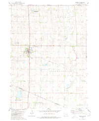
Delmont serves as the primary hub of this Douglas County landscape, situated at the southern edge of the township boundaries for Lincoln, Belmont, and Independence. The town is characterized by its organized grid and proximity to the Delmont Cem and a Sewage Disposal Pond to the east. A notable remnant of earlier transportation infrastructure is the Old Railroad Grade (marked elsewhere as Old RR Gr), which cuts diagonally across the prairie from the northwest toward the town site.
Find a feature on this map
18 named features on this map. Tap any name to fly to it.
Don’t see what you’re looking for? This feature index may not catch every label — zoom into the map to look around manually.
Map Details
Editions of this 1979 Delmont Map
This is the sole edition of this map. No revisions or reprints were ever made.
Other maps of this area

1955 · Mitchell
USGS Topo · 1:250,000

1959 · Mitchell
USGS Topo · 1:250,000

1964 · Wagner NE
USGS Topo · 1:24,000

1977 · Oak Hollow
USGS Topo · 1:24,000
1977 · Wagner NE
USGS Topo · 1:24,000

1978 · Oak Hollow
USGS Topo · 1:24,000
1978 · Greenwood Colony
USGS Topo · 1:24,000
1979 · Delmont NE
USGS Topo · 1:24,000
1979 · Delmont SE
USGS Topo · 1:24,000
1979 · Armour
USGS Topo · 1:24,000
Featured Places
- Delmont, SD
- Lincoln Township, SD
- Independence Township, SD
- Belmont Township, SD
- East Choteau Township, SD