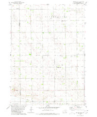
1979 Map of Delmont SE
USGS Topo · Published 1980About this map
Rural life in the southeastern corner of Douglas County and western Hutchinson County is defined by a grid of fence lines and small community centers in this late 1970s survey. The landscape is marked by several significant burial sites for local families, including Hoffnungsberg Cem, Eigenfeld Cem, and St Marys Cem. Near the small settlement of Townhall, the drainage patterns of North Branch Dry Creek and South Branch Dry Creek carve into the prairie, illustrating the importance of natural watersheds in this agricultural region.
Find a feature on this map
15 named features on this map. Tap any name to fly to it.
Don’t see what you’re looking for? This feature index may not catch every label — zoom into the map to look around manually.
Map Details
Editions of this 1979 Delmont SE Map
This is the sole edition of this map. No revisions or reprints were ever made.
Other maps of this area

1898 · Olivet
USGS Topo · 1:125,000

1955 · Sioux Falls
USGS Topo · 1:250,000

1955 · Mitchell
USGS Topo · 1:250,000

1958 · Sioux Falls
USGS Topo · 1:250,000

1959 · Mitchell
USGS Topo · 1:250,000

1977 · Oak Hollow
USGS Topo · 1:24,000

1978 · Oak Hollow
USGS Topo · 1:24,000
1978 · Greenwood Colony
USGS Topo · 1:24,000
1978 · Tripp
USGS Topo · 1:24,000

1979 · Delmont
USGS Topo · 1:24,000
Featured Places
- Lincoln Township, SD
- Oak Hollow Township, SD
- Susquehanna Township, SD
- Kulm Township, SD
- Belmont Township, SD