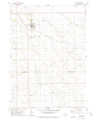
1978 Map of Tripp
USGS Topo · Published 1979About this map
Tripp serves as the focal point of this late-1970s survey, situated along the Chicago Milwaukee St Paul And Pacific railroad line. The landscape is characterized by a high concentration of institutional landmarks, particularly numerous cemeteries such as Holy Rosary Cem, Friedens Cem, and Grace Hill Cem that clustered near the town site. The map documents the rural infrastructure of the era, from the local Fairground and Sewage Disposal Pond to the gravel extraction sites peppered across the countryside.
Find a feature on this map
26 named features on this map. Tap any name to fly to it.
Don’t see what you’re looking for? This feature index may not catch every label — zoom into the map to look around manually.
Map Details
Editions of this 1978 Tripp Map
This is the sole edition of this map. No revisions or reprints were ever made.
Other maps of this area

1898 · Olivet
USGS Topo · 1:125,000

1955 · Sioux Falls
USGS Topo · 1:250,000

1955 · Mitchell
USGS Topo · 1:250,000

1958 · Sioux Falls
USGS Topo · 1:250,000

1959 · Mitchell
USGS Topo · 1:250,000

1977 · Oak Hollow
USGS Topo · 1:24,000

1978 · Tripp SE
USGS Topo · 1:24,000

1978 · Oak Hollow
USGS Topo · 1:24,000
1978 · Haucks Lake
USGS Topo · 1:24,000
1978 · Kaylor
USGS Topo · 1:24,000