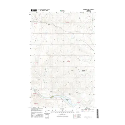
2017 Map of Armstrong Creek
USGS Topo · Published 2017About this map
The Columbia River carves the southern boundary of this Okanogan County landscape, where the Nespelem River joins the main flow near Nespelem Bar. The terrain is defined by dramatic elevation changes, from the alluvial Bissell Flat along the riverbanks to the heights of Squaw Mtn and Mineral Ridge. High-altitude water features such as Armstrong Meadow and Grant Lake feed the drainages that eventually drop toward the canyon floor, including the waters of Multnomah Falls and Spray Falls.
Find a feature on this map
47 named features on this map. Tap any name to fly to it.
Don’t see what you’re looking for? This feature index may not catch every label — zoom into the map to look around manually.
Map Details
Editions of this 2017 Armstrong Creek Map
This is the sole edition of this map. No revisions or reprints were ever made.
Other maps of this area

1950 · Nespelem
USGS Topo · 1:62,500

1950 · Alameda Flat
USGS Topo · 1:62,500

1952 · Alameda Flat
USGS Topo · 1:62,500

1952 · Disautel
USGS Topo · 1:62,500

1953 · Bald Knob
USGS Topo · 1:62,500

1954 · Okanogan
USGS Topo · 1:250,000

1958 · Okanogan
USGS Topo · 1:250,000
1983 · Omak
USGS Topo · 1:100,000

1984 · Nespelem
USGS Topo · 1:100,000
1989 · Disautel
USGS Topo · 1:24,000