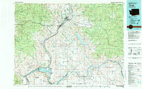
1983 Map of Omak
USGS Topo · Published 1983About this map
The Okanogan River corridor defines the heart of this region, winding past the commercial centers of Omak and Okanogan before joining the Columbia River near Brewster. This 1983 survey captures a landscape of intense geographic contrast, where the irrigated orchards and homesteads of the river flats meet the high timber of the Okanogan National Forest. To the east, the vast Colville Indian Reservation contains the massive, elongated basin of Omak Lake and the high point of Whitmore Mountain. For the local historian, the map preserves a detailed view of the regional infrastructure of the early 1980s, including the Burlington Northern railroad line and the numerous rural junctions like Nilles Corner and Osborne Corner. Evidence of the area's resource history is scattered throughout the higher terrain, notably at the Red Shirt Mine near the western edge and the Hough Mine tucked into the northern ridges.
Find a feature on this map
82 named features on this map. Tap any name to fly to it.
Don’t see what you’re looking for? This feature index may not catch every label — zoom into the map to look around manually.
Map Details
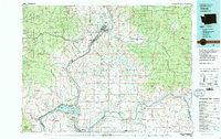
Editions of this 1983 Omak Map
2 editions found
Other maps of this area

1899 · Methow
USGS Topo · 1:125,000

1901 · Chelan
USGS Topo · 1:125,000

1901 · Methow
USGS Topo · 1:125,000

1902 · Osoyoos
USGS Topo · 1:125,000

1904 · Osoyoos
USGS Topo · 1:125,000

1904 · Republic
USGS Topo · 1:125,000

1905 · Okanogan
USGS Topo · 1:125,000

1906 · Chopaka
USGS Topo · 1:125,000

1948 · Grand Coulee Dam
USGS Topo · 1:62,500

1950 · Grand Coulee Dam
USGS Topo · 1:62,500