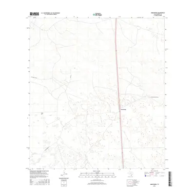
2016 Map of Armstrong
USGS Topo · Published 2016About this map
Armstrong serves as a primary reference point in this sparse South Texas landscape, situated along the corridor that bisects the ranchlands of Kenedy County. The area is defined by its expansive private holdings and specialized transportation infrastructure, including the Armstrong Ranch Airport and several private thoroughfares like Los Pobres Camp Rd and Comal Rd. Natural topographic variations are subtle across this terrain, punctuated by features such as Tokyo Hill. To the south, Tobin Armstrong Rd provides access into the interior of these large-scale ranching operations. The map illustrates a modern era of land management where traditional cattle-ranching territory is navigated by a combination of rural roads and localized air travel infrastructure, characteristic of the remote coastal plains of the region.
Find a feature on this map
6 named features on this map. Tap any name to fly to it.
Don’t see what you’re looking for? This feature index may not catch every label — zoom into the map to look around manually.
Map Details
Editions of this 2016 Armstrong Map
This is the sole edition of this map. No revisions or reprints were ever made.
Other maps of this area

1923 · Armstrong
USGS Topo · 1:62,500

1923 · Saltillo Ranch
USGS Topo · 1:62,500

1928 · Sarita
USGS Topo · 1:125,000

1950 · Corpus Christi
USGS Topo · 1:250,000

1953 · Brownsville
USGS Topo · 1:250,000

1954 · La Parra Ranch SW
USGS Topo · 1:24,000

1954 · Sarita
USGS Topo · 1:62,500
1955 · La Parra Ranch
USGS Topo · 1:62,500

1956 · Corpus Christi
USGS Topo · 1:250,000

1956 · Pita Camp
USGS Topo · 1:24,000