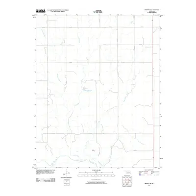
2010 Map of Arnett SE
USGS Topo · Published 2010About this map
The Canadian River meanders across the southern edge of this Oklahoma landscape, defining the local drainage pattern where several tributaries converge. In the early 21st century, the area remains dominated by a systematic grid of section-line roads, including E 0620 RD and N 1780 RD, which navigate the subtle rises between watercourses. A primary point of local interest is the Grand Cemetery, situated near the southern bends of Mosquito Creek. Further north, water management is evident at the Parker Number 1 Dam, which creates the Parker Number 1 Reservoir along the path of Red Bluff Creek. This survey illustrates the persistent rural structure of Ellis County, where cattle ranching and agriculture are supported by the various branches of West Red Bluff Creek and Little Turkey Creek flowing toward the river basin.
Find a feature on this map
21 named features on this map. Tap any name to fly to it.
Don’t see what you’re looking for? This feature index may not catch every label — zoom into the map to look around manually.
Map Details
Editions of this 2010 Arnett SE Map
This is the sole edition of this map. No revisions or reprints were ever made.
Other maps of this area

1955 · Clinton
USGS Topo · 1:250,000

1955 · Woodward
USGS Topo · 1:250,000

1957 · Clinton
USGS Topo · 1:250,000

1958 · Woodward
USGS Topo · 1:250,000

1965 · Roll NW
USGS Topo · 1:24,000

1966 · Antelope Hills NE
USGS Topo · 1:24,000

1966 · Antelope Hills
USGS Topo · 1:24,000

1970 · Arnett
USGS Topo · 1:24,000

1970 · Arnett SE
USGS Topo · 1:24,000

1970 · Harmon SW
USGS Topo · 1:24,000