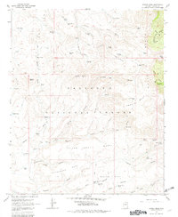
1967 Map of Arnold Mesa
USGS Topo · Published 1982About this map
Prescott National Forest encompasses this high plateau landscape in central Arizona, dominated by the expansive Arnold Mesa. This 1967 field-checked survey reveals a rugged geography of mesas and canyons utilized primarily for ranching and water management. Several distinct mesa formations, including Yellow Jacket Mesa, Cottonwood Mesa, and Marlow Mesa, are dissected by deep draws and gulches. The reliance on scattered water sources is evident through the naming of various springs and tanks, such as Joe Best Spring, Wilson Spring, and Clays Well. The presence of the Arnold Place settlement and numerous named stock tanks like Watters Tank and Hog Basin Tank highlights the area's importance to local cattle operations during the mid-20th century. High points like Squaw Peak and the Black Hills range along the eastern edge provide significant topographic relief to the mesa-heavy terrain.
Find a feature on this map
67 named features on this map. Tap any name to fly to it.
Don’t see what you’re looking for? This feature index may not catch every label — zoom into the map to look around manually.
Map Details
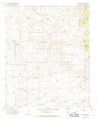
Editions of this 1967 Arnold Mesa Map
2 editions found
Other maps of this area

1887 · Verde
USGS Topo · 1:250,000

1887 · Prescott
USGS Topo · 1:250,000

1892 · Verde
USGS Topo · 1:250,000

1892 · Prescott
USGS Topo · 1:250,000

1903 · Bradshaw Mountains
USGS Topo · 1:125,000

1905 · Jerome
USGS Topo · 1:125,000

1923 · Camp Verde
USGS Topo · 1:125,000

1929 · Turret Peak
USGS Topo · 1:125,000

1932 · Camp Verde
USGS Topo · 1:125,000

1933 · Turret Peak
USGS Topo · 1:125,000