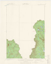
1932 Map of Arnold Pond
USGS Topo · Published 1966About this map
The United States Canada international boundary cuts a jagged path through this 1932 survey, defining the northwestern edge of Franklin Co and Oxford Co. This borderland is defined by a dense network of water bodies, most notably the Chain of Ponds and the headwaters of the Magalloway River. The presence of the U.S. Customs station near Arnold Pond indicates the significance of this mountain pass as a formal entry point from Quebec.
Find a feature on this map
32 named features on this map. Tap any name to fly to it.
Don’t see what you’re looking for? This feature index may not catch every label — zoom into the map to look around manually.
Map Details
Editions of this 1932 Arnold Pond Map
3 editions found
Other maps of this area

1927 · Moose Bog
USGS Topo · 1:48,000

1927 · Second Lake
USGS Topo · 1:62,500

1928 · Chain Lakes
USGS Topo · 1:48,000

1928 · Skinner
USGS Topo · 1:48,000

1931 · Cupsuptic
USGS Topo · 1:48,000

1931 · Skinner
USGS Topo · 1:62,500

1931 · Moose Bog
USGS Topo · 1:62,500

1932 · Kennebago Lake
USGS Topo · 1:48,000

1932 · Second Lake
USGS Topo · 1:62,500

1932 · Arnold Pond
USGS Topo · 1:48,000