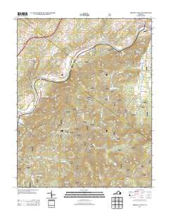
2013 Map of Arnold Valley
USGS Topo · Published 2013About this map
Glenwood Furnace stands as a testament to the industrial history along the James River, where the terrain of the Blue Ridge transitions toward the water. This 2013 survey reveals a landscape where recreation and heritage intersect, showing sites like the Natural Bridge Camp for Boys and the Hopper Creek Group Camp established amidst the complex ridge systems of Skillern Mountain and Cave Mountain. Small river-side settlements such as Gilmore Mills, Rocky Point, and Solitude dot the valley, while higher elevations are marked by the Blue Ridge Pkwy and notable natural features like Apple Orchard Falls. The presence of the Black Bridge Airport and Natural Bridge Station highlights the area's continued role as a transit corridor through the gap, connecting the peaks to the river's edge.
Find a feature on this map
66 named features on this map. Tap any name to fly to it.
Don’t see what you’re looking for? This feature index may not catch every label — zoom into the map to look around manually.
Map Details
Editions of this 2013 Arnold Valley Map
This is the sole edition of this map. No revisions or reprints were ever made.
Other maps of this area

1890 · Roanoke
USGS Topo · 1:125,000

1891 · Roanoke
USGS Topo · 1:125,000

1892 · Lynchburg
USGS Topo · 1:125,000

1894 · Natural Bridge
USGS Topo · 1:125,000

1894 · Lexington
USGS Topo · 1:125,000

1894 · Natural Bridge
USGS Topo · 1:62,500

1907 · Natural Bridge Special
USGS Topo · 1:62,500

1935 · Buena Vista
USGS Topo · 1:48,000

1939 · Buena Vista
USGS Topo · 1:62,500

1940 · Buena Vista
USGS Topo · 1:62,500