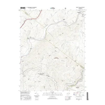
2016 Map of Arnold Valley
USGS Topo · Published 2016About this map
The James River carves through the landscape of the Blue Ridge here, where the river valley historically facilitated both transport and settlement. At Gilmore Mills and Natural Bridge Station, the relationship between the waterway and early industrial sites is evident, while the high country to the south is preserved within the Jefferson National Forest. This terrain is defined by prominent ridges like Snakeden Ridge and Southside Ridge, with the Appalachian National Scenic Trail winding through the southern mountains toward Apple Orchard Mtn. For those tracing family histories, the map identifies several local burial grounds, including High Bridge Cem, Mount Olivet Cem, and the Robinson Cem near Arcadia. Small clusters of settlement at Alpine and Solitude reflect the era's rural character, connected by roads like the S Lee Hwy and the winding Blue Ridge Pkwy.
Find a feature on this map
101 named features on this map. Tap any name to fly to it.
Don’t see what you’re looking for? This feature index may not catch every label — zoom into the map to look around manually.
Map Details
Editions of this 2016 Arnold Valley Map
This is the sole edition of this map. No revisions or reprints were ever made.
Other maps of this area

1890 · Roanoke
USGS Topo · 1:125,000

1891 · Roanoke
USGS Topo · 1:125,000

1892 · Lynchburg
USGS Topo · 1:125,000

1894 · Natural Bridge
USGS Topo · 1:125,000

1894 · Lexington
USGS Topo · 1:125,000

1894 · Natural Bridge
USGS Topo · 1:62,500

1907 · Natural Bridge Special
USGS Topo · 1:62,500

1935 · Buena Vista
USGS Topo · 1:48,000

1939 · Buena Vista
USGS Topo · 1:62,500

1940 · Buena Vista
USGS Topo · 1:62,500