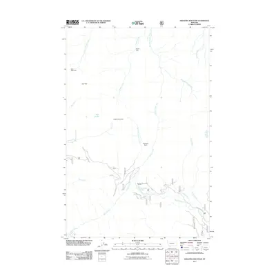
2011 Map of Arrastra Mountain
USGS Topo · Published 2011About this map
Arrastra Mountain and Iron Mountain dominate this section of the Helena National Forest, where high-altitude drainages form the headwaters of numerous creeks. The 2011 landscape is defined by its water systems, from the high Alpine Park in the north to the confluence of Beaver Creek and Yukon Creek in the south. The presence of the Reservoir Lake Livestock Trail Head near Reservoir Lake indicates the continued importance of high-country grazing and packing routes in this region of Montana. Smaller features like Nolo Lake and the dry bed of Dry Creek punctuate the terrain between Daly Peak and the Porcupine Basin. This survey reflects the modern management of these public lands, documenting the Forest Service road network including N Beaver Creek Rd as it follows the winding path of the local waterways.
Find a feature on this map
22 named features on this map. Tap any name to fly to it.
Don’t see what you’re looking for? This feature index may not catch every label — zoom into the map to look around manually.
Map Details
Editions of this 2011 Arrastra Mountain Map
This is the sole edition of this map. No revisions or reprints were ever made.
Other maps of this area

1889 · Helena
USGS Topo · 1:250,000

1893 · Helena
USGS Topo · 1:250,000

1899 · Helena
USGS Topo · 1:250,000

1903 · Coopers Lake
USGS Topo · 1:125,000

1903 · Helena
USGS Topo · 1:250,000

1947 · Butte
USGS Topo · 1:250,000

1955 · Choteau
USGS Topo · 1:250,000

1957 · Choteau
USGS Topo · 1:250,000

1958 · Butte
USGS Topo · 1:250,000

1958 · Choteau
USGS Topo · 1:250,000