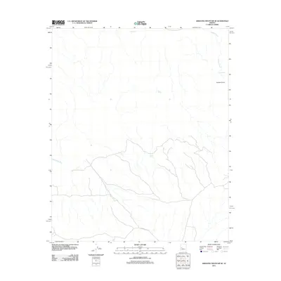
2011 Map of Arrastra Mountain SE
USGS Topo · Published 2011About this map
The Santa Maria River cuts through this arid landscape in Yavapai County, marking a vital water source in an area defined by deep drainage systems and remote desert terrain. This 2011 survey illustrates the sparse infrastructure of the region, where Palmerita Rd provides one of the few named access routes across the southern portion of the quadrangle. The topography is dominated by the complex network of Peoples Canyon and its tributaries, including Peeples Creek, which together drain the surrounding uplands. Small-scale water features such as Sams Spring, Burro Spring, and Fork Spring indicate the critical importance of isolated seeps and catchments like Catclaw Tank for local wildlife and occasional rangeland use in this corner of the Arizona desert.
Find a feature on this map
8 named features on this map. Tap any name to fly to it.
Don’t see what you’re looking for? This feature index may not catch every label — zoom into the map to look around manually.
Map Details
Editions of this 2011 Arrastra Mountain SE Map
This is the sole edition of this map. No revisions or reprints were ever made.
Other maps of this area

1923 · Signal
USGS Topo · 1:250,000

1942 · Signal
USGS Topo · 1:250,000

1950 · Prescott
USGS Topo · 1:250,000

1954 · Prescott
USGS Topo · 1:250,000

1958 · Prescott
USGS Topo · 1:250,000

1959 · Prescott
USGS Topo · 1:250,000

1960 · Prescott
USGS Topo · 1:250,000

1965 · Prescott
USGS Topo · 1:250,000
1967 · Date Creek Ranch NW
USGS Topo · 1:24,000
1967 · Arrastra Mtn SE
USGS Topo · 1:24,000