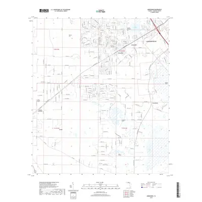
2018 Map of Arredondo
USGS Topo · Published 2018About this map
Kanapaha Presbyterian Church stands as a focal point near Arredondo, representing the settled history of this Alachua County landscape. The map reveals a transition between the southwestern suburbs of Gainesville and the expansive wet prairies that define the North Florida interior. Natural depressions and karst features such as Hickory Sink are prominent, alongside broad lowlands like Kanapaha Prairie, Grass Prairie, and the edges of Paynes Prairie. Small communities and named locales including Wacahoota, Archer, and Peach Orchard dot the map, connected by a dense grid of residential roads. The presence of Peach Orchard Airport and the proximity of Lake Kanapaha suggest a mix of rural legacy and modern development. Water levels in basins like Levy Lake provide a clear view of the hydrological patterns that have shaped land use and settlement in this portion of the Florida peninsula.
Find a feature on this map
130 named features on this map. Tap any name to fly to it.
Don’t see what you’re looking for? This feature index may not catch every label — zoom into the map to look around manually.
Map Details
Editions of this 2018 Arredondo Map
This is the sole edition of this map. No revisions or reprints were ever made.
Other maps of this area

1890 · Arredondo
USGS Topo · 1:62,500

1892 · Arredondo
USGS Topo · 1:62,500

1894 · Arredondo
USGS Topo · 1:62,500

1895 · Williston
USGS Topo · 1:62,500

1954 · Gainesville
USGS Topo · 1:250,000

1955 · Bronson NE
USGS Topo · 1:24,000

1958 · Gainesville
USGS Topo · 1:250,000

1959 · Gainesville
USGS Topo · 1:250,000
1966 · Micanopy
USGS Topo · 1:24,000

1966 · Gainesville West
USGS Topo · 1:24,000