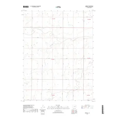
2019 Map of Arriba NE
USGS Topo · Published 2019About this map
The Arikaree River meanders across this high plains landscape of northeast Lincoln County, carving a distinct valley through the open terrain. In 2019, this section of eastern Colorado remained defined by its watercourses and a sparse, geometric grid of county roads serving the agricultural community. Several intermittent streams, including Dugout Creek and Hell Creek, flow toward the river, illustrating the drainage patterns essential to the region's ranching and farming operations. The township and range lines, such as t7s r53w and t6s r52w, provide the primary structure for property boundaries in this rural expanse. Local transportation is anchored by Co Hwy 63, which runs north-south through the eastern half of the map, connected by a network of gravel routes like Co Rd 3X and Co Rd 41 that follow the section lines.
Find a feature on this map
24 named features on this map. Tap any name to fly to it.
Don’t see what you’re looking for? This feature index may not catch every label — zoom into the map to look around manually.
Map Details
Editions of this 2019 Arriba NE Map
This is the sole edition of this map. No revisions or reprints were ever made.
Other maps of this area

1954 · Limon
USGS Topo · 1:250,000

1957 · Limon
USGS Topo · 1:250,000

1958 · Limon
USGS Topo · 1:250,000

1973 · Lindon SW
USGS Topo · 1:24,000

1973 · Shaw
USGS Topo · 1:24,000

1977 · Thurman
USGS Topo · 1:24,000

1979 · Arriba NW
USGS Topo · 1:24,000

1979 · Arriba
USGS Topo · 1:24,000

1979 · Flagler SW
USGS Topo · 1:24,000

1979 · Genoa East
USGS Topo · 1:24,000