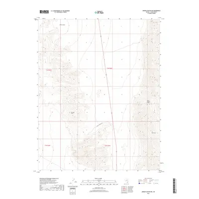
2018 Map of Arrow Canyon NW
USGS Topo · Published 2018About this map
The Las Vegas Range and Arrow Canyon Range dominate this desert landscape in Clark County, showing a high-contrast terrain of sharp ridgelines and deep drainage basins. Movement through this arid region is defined by the corridors of Elbow Canyon in the north and Side Canyon to the southeast, while U.S. Route 93 provides the primary north-south transit route. For those following historic paths, the Gunsight Mountain Trl winds through the central elevations. This 2018 survey illustrates the persistent isolation of this corner of Nevada, where the land is largely shaped by geologic features rather than human settlement, preserved within the traditional public land survey system grid of t14s r63e and its neighbors.
Find a feature on this map
10 named features on this map. Tap any name to fly to it.
Don’t see what you’re looking for? This feature index may not catch every label — zoom into the map to look around manually.
Map Details
Editions of this 2018 Arrow Canyon NW Map
This is the sole edition of this map. No revisions or reprints were ever made.
Other maps of this area

1886 · Saint Thomas
USGS Topo · 1:250,000

1893 · Saint Thomas
USGS Topo · 1:250,000

1907 · Las Vegas
USGS Topo · 1:250,000

1908 · Las Vegas
USGS Topo · 1:250,000

1945 · Sheep Range
USGS Topo · 1:125,000

1954 · Las Vegas
USGS Topo · 1:250,000

1957 · Las Vegas
USGS Topo · 1:250,000

1958 · Arrow Canyon
USGS Topo · 1:62,500

1959 · Las Vegas
USGS Topo · 1:250,000

1960 · Hayford Peak
USGS Topo · 1:62,500