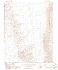
1986 Map of Arrow Canyon NW
USGS Topo · Published 1986About this map
The Las Vegas Range and the Arrow Canyon Range converge in this high-desert region of Clark County, creating a dramatic landscape of steep ridges and desert washes. The western portion of the map is dominated by the Desert National Wildlife Range, defined here by an Indefinite Boundary through the rugged peaks. This 1980s survey captures a wilderness largely untouched by development, where human activity is limited to a single Trans Line cutting north-to-south and a solitary Gravel Pit near the northern edge. Evidence of backcountry navigation is visible through a network of 4wd tracks and trails navigating the complex topography near Elbow Canyon, reflecting the area's role as a remote refuge and a challenging environment for early surveyors and contemporary explorers alike.
Find a feature on this map
8 named features on this map. Tap any name to fly to it.
Don’t see what you’re looking for? This feature index may not catch every label — zoom into the map to look around manually.
Map Details
Editions of this 1986 Arrow Canyon NW Map
This is the sole edition of this map. No revisions or reprints were ever made.
Other maps of this area

1886 · Saint Thomas
USGS Topo · 1:250,000

1893 · Saint Thomas
USGS Topo · 1:250,000

1907 · Las Vegas
USGS Topo · 1:250,000

1908 · Las Vegas
USGS Topo · 1:250,000

1945 · Sheep Range
USGS Topo · 1:125,000

1954 · Las Vegas
USGS Topo · 1:250,000

1957 · Las Vegas
USGS Topo · 1:250,000

1958 · Arrow Canyon
USGS Topo · 1:62,500

1959 · Las Vegas
USGS Topo · 1:250,000

1960 · Hayford Peak
USGS Topo · 1:62,500