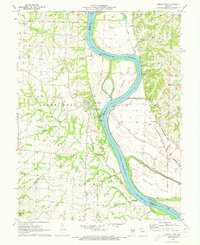
1971 Map of Arrow Rock
USGS Topo · Published 1973About this map
Arrow Rock serves as the focal point of this Missouri riverfront survey, positioned on the bluffs above the wide channel where the Saline and Howard county lines meet. The landscape is defined by the shifting course of the Missouri River, which creates complex landforms like Jameson Island and Wallace Island, protected in part by a system of levees. To the north and west, the terrain rises into hills drained by Pierre Fleche Creek and Wood Branch, where early settlement is marked by sites such as Concord Ch and Salem Ch.
Find a feature on this map
44 named features on this map. Tap any name to fly to it.
Don’t see what you’re looking for? This feature index may not catch every label — zoom into the map to look around manually.
Map Details
Editions of this 1971 Arrow Rock Map
2 editions found
Other maps of this area

1887 · Sedalia
USGS Topo · 1:125,000

1888 · Boonville
USGS Topo · 1:125,000

1890 · Glasgow
USGS Topo · 1:125,000

1890 · Marshall
USGS Topo · 1:125,000

1892 · Marshall
USGS Topo · 1:125,000

1894 · Sedalia
USGS Topo · 1:125,000

1901 · Marshall
USGS Topo · 1:125,000

1940 · Marshall
USGS Topo · 1:62,500

1944 · Marshall
USGS Topo · 1:62,500

1947 · Glasgow
USGS Topo · 1:62,500